Home Again

As I go back over my photos I am overwhelmed by what we did and where we went. It is almost too much to grasp. We traveled  almost 12,000 miles through 19 states and 4 Canadian Provinces. We stayed at 36 campsites and I disposed of I don’t know how many poop bags. In the 70 days we were gone I wrote 42 posts and  took hundreds of images.

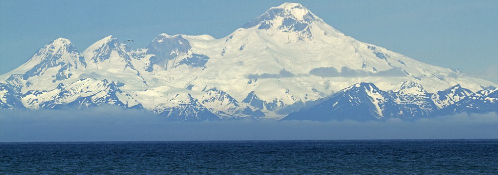
Looking at my images, I realize the amount of wildlife we saw–brown bears, black bears, elk, moose, deer, antelope, bison, stone sheep, mountain sheep–all the different birds–eagles, sea gulls, white faced Ibis, a variety of sparrows, magpies, trumpeter swans and more. We experienced all kinds of weather from snow to rain storms to 60mph winds to 107 degree temperatures. We drove through the mountains from the Appalachians to the Norther Rockies, across the plains of the midwest , through deserts and over bumpy dirt roads. We saw incredible scenery all over the US, Alaska and Canada. What a vast, diverse and beautiful country North America is.

Would we drive to Alaska again? Probably not. However, we would return and probably rent an RV for a couple of weeks while there. We accomplished what we set out to–to see Alaska and our old home and to visit the Grand Staircase-Escalante Monument in Utah. Along with this we saw and experienced so much more.

We left Cades Cove on Sunday, July 31 and got home in the early evening. It really was nice to be home. However, both of us were pretty disoriented moving from the small confines of the motor home to a 4000 square foot house. I didn’t even make it upstairs until the next day.  There was food shopping to do, mail to sort, clothes to wash, the motor home to empty and family to call. We’re slowly working our way back to normalcy.

I did get to Cades Cove that morning for sunrise. Though it was not a spectacular sunrise, the mist and the deer did not disappoint.  Here are some of the images I took.

Deer eating flowers

Buck posing

Mist in the valley

2 deer


It has been a lot of fun and work keeping this blog going. There were times I felt like I had to meet a deadline. If I skipped a couple of days friends would email me concerned about where we were and if we were OK. I have gotten so much wonderful feedback from so many of you who followed our daily exploits. And I thank you for your comments. It’s almost sad to bring this to an end.

But, just wait. Next year we plan to go to Nova Scotia and  Newfoundland. So get your woolies on and get ready to ride with us.


Cades Cove, Tenn.

Tomorrow will be our last day on the road for this trip. Over a period of 70 days, we will have driven ~11,735 miles through 19 states and 4 Canadian Provinces and have stayed at 36 campsites. It has been quite a trip!

Cades Cove in Tennessee seemed like the perfect place to end this sojourn. We both love it here and feel so comfortable and at home in the Smoky Mountains. Because we couldn’t drive the loop this sunup (no motor vehicles before 10 am) we decided to explore the surrounding area. We drove part of the loop and took off onto Parsons Branch Road, an 8 mile dirt road (driving time ~1 hour) through pristine forests and rippling streams. Rays of light filtered through the thick foliage as we wended our way over gravel and dirt. We stopped and picnic’ d  at the halfway mark.  It was wonderfully quiet and peaceful.

Old Wooden Bridge in Cades Cove

Waterfalls off of Parsons Branch Road

Then we hit Rte 129!!  It’s a twisty, winding road that is used by motorcyclists and sports car drivers as a seeming racetrack.  Here we were in our little Tracker, having just turned off our four wheel drive after the driving “hike” through the woods!  We were tailgated by “crotch rockets” & photographed around each curve by professional photogs who post their pix of the drivers on the internet for sale to the very same drivers!!  Well, at first we were intimidated by the traffic; however, we got into it & , even with the lowly Tracker, outpaced the sports cars on the tight curves.  Thankfully we slowed down just before the end of the curvy part of the road, as the cops were sitting at the bottom & pulling lots of drivers.  Pulling onto the Foothills Parkway, we worked our way back to the campsite.  A great last day!

Tomorrow I plan to be at the loop before sunrise to take in the best of Cades Cove–the amazing mist that envelops this valley–and hopefully get some good images.

Then it’s home. I will probably write one more post after this and recap our trip.

Mountain View, Arkansas

The only reason we ended up in Mountain View, AR was because my brother-in-law Danny said we had to go to McSpadden’s, the makers of mountain dulcimers since 1962. You see, Danny bought his McSpadden dulcimer in NYC back in 1972 and has always wanted to visit the place where it was made. So, I guess, our being here is the next best thing. McSpadden Mountain Dulcimers is the largest dulcimer marker in the US having made more than 55,ooo of these hand crafted instruments since their beginning. Presently there are 5 artisans who craft these insturments, several who have been using the same tools for the past 38 years. There is a large window at the end of the shop where you can watch the dulcimers being made. Its sweet sound envelops you as you walk throughout the store.

Dulcimer Maker

The Dulcimer shop

A selection of McSpadden Dulcimers

Mountain View, population about 3,ooo, is located in the Ozarks surrounded by mountains and rivers. Its claim to fame is its folkways and traditional music which can be heard throughout the area. Saturday night is pickin’ time on the square downtown. This is also the home of the Arkansas Folk Festival. Unfortunately, it is so darn hot (over 100) there are few people to be found out and about.

We walked around the quaint downtown and browsed in the various flea markets and shops. We did visit a small vegetable stand yesterday and today to buy fresh grown tomatoes and cucumbers. (There’s nothing like fresh tomato and cucumber sandwiches with mayo!) The old gentleman who tended the stand was delightful. Yesterday he showed me a baby robin he had saved. Apparently the poor thing had fallen out of the nest and couldn’t fly. So he’s been keeping it fed on  peaches and vegetables. Today when I came by he told me that the robin had flown on to his shoulder. Suddenly mama appeared and the baby took off. He was so proud of his “offspring”.

Baby Robin

Tomorrow we head to Tennessee. Maybe we can catch a little respite from this enervating heat when we hit the Smoky Mountains. I hope so.

Escalante Addendum

Here’s a video of our trips through the rugged “roads” in the Grand Staircase, Escalante National Monument where Barbara took many a photo of hoodoos & arches,etc. (see the post containing the Grosvenor Arch).  The rides were difficult, but rewarding & fun (at least for me).

Enjoy the ride-along.  Michael

http://www.youtube.com/watch?v=njbEW0ESx3M

Russellville, Arkansas

We ended up in Russellville, Arkansas by chance. It was not a place we had picked out to stay. After 2 days and 1,057 miles across I-40 we kind of landed here. We rushed through the rest of Arizona, New Mexico, spent the night in Amarillo, TX and then sped through Oklahoma trying to get out of the flat lands. The interstate consisted of scattered truck stops, glitzy casinos and miles and miles and miles of nothing. When we finally saw trees, lakes and rivers (with water in them) we stopped. It was time to take a break. So here we are, our third day of respite, in Russellville, a surprisingly very nice place. The heat is intense as is the humidity–yes, our first encounter with humidity. We’ve sat around reading, watching movies, listening to the radio and just laying back. It has been a pleasure.

This morning we actually ventured out of the motor home and went to Mt. Nebo State Park. Mt. Nebo, 1,350 feet above the mountain valleys of west central Arkansas, overlooks the 34,000 acre Lake Dardanelle and the Arkansas River. The 20 minute ride took us along narrow switchbacks bordered by rugged rocks. We stopped to look at the lake and valleys below and drove around the well tended park. Deer wandered unobstructed throughout the park. We even got to see a Pileated Woodpecker.  We drove down to the lake and the dam and watched turkey vultures and herons sunning themselves on the pilings along the banks.

Lake Dardanelle

2 deer

3 birds

We are gearing down and slowly working our way home. There’s no rush, no particular destination. We have plenty of time to feel our way back to North Carolina. We may even spend a day in Mountain View, Arkansas at the suggestion of my brother-in-law. For sure we’re headed to Cades Cove in Tennessee for a couple of days. Then home.

Petrified Forest

Dry, desolate and hot. That’s the only way I can describe this part of Arizona. The oppressive heat saps your energy and the endless grasslands lull you into questioning whether anyone could actually live out here.  Its history of giant glaciers, volcanoes, dinosaurs and ancient peoples are evidenced in the lay of the land. But it is really not our kind of place.

Michael has wanted to see the Petrified Forest ever since he saw the movie of that name with  Humphery Bogart, Betty Davis and Leslie Howard.  This 1932 film was probably shot on a Hollywood lot but nonetheless, he wanted to see it for himself.  We got to the National Park about 10 am. Temperatures were moderate and the skies overcast—perfect. The first 17 of the 28 miles were the Painted Desert. There is a strange beauty in this vast, dry land of low hills and yellow buckwheat flowers. We watched as the sun shifted, changing the desert colors from dark brown to vermillion to deep reds and the yellow buckwheat flowers from beige to golden. We were told that the best time to photograph the painted desert was at sunset.  However, the park closes before that  and, though I tried, I was unable to get permission to come in at that time. We also saw common nighthawks flying over the painted desert.  They are on my list of birds I will probably never be able to photograph because of their size and speed. The others include swallows and swifts.

Painted Desert

As the sun burned off the clouds and the heat intensified, we drove into the Petrified Forest. It is not really a forest as I think of one, but a vast terrain of low hills in hues of burnt sienna ( some in the shape of teepees) , large granite rocks,  and pieces of petrified wood scattered throughout the landscape. We visited an excavated pueblo and kiva supposedly inhabited thousands of years ago by what is believed to be the ancestors of the Hopi, Navajo and Zuni Indians. Many of the rocks contained petroglyphs.

Petroglyphs

Teepees

The more we stopped at each pull off the more miserable Michael and Lily became. The heat was intense and the sun consuming. While they sat in the air conditioned Tracker, I persevered  over a ¾  mile trail to photograph the  petrified wood. There were beautiful pieces laced with azure, magenta and orange colors. We did get to see “Old Faithful”, one of the largest pieces of petrified wood in the park.

Petrified Wood

"Old Faithful"

Unfortunately, as we were getting out of the car at a viewing area I dropped my 5D Mark II on the ground. The polarizing filter flew off and shattered as the camera hit the ground lens first. The camera works fine but the ridge of the lens dented to the extent that I cannot put a filter or lens cap on it. I switched from the 24-70 to my 17-40 wide angle lens which actually worked quite well  for  photographing the petrified wood.

One of the highlights of the day was a visit to Stewart’s Rock Shop. A couple we had met at the Bryce Canyon campground recommended we stop there. The outside of the shop can only be described as unique.  The shop, located just off of I-40, is run by Stewart, a tiny, old black woman with short dreadlocks and several missing front teeth who knew everything there was to know about every rock and stone in the well stocked store. She was nice enough to let us bring Lily in with us as we grazed through the aisles and aisles and shelves of petrified wood, fossils and stone.  The assortment was overwhelming. Ironically, we ended up purchasing a beautiful 12” diameter Ammonite from Morocco. We also picked up a couple of local things for the grand kids.

Stewart's Petrified Wood Shop

Hot is hot no matter how dry it is. Even though we had left the air conditioning on in the motor home it did nothing to lessen the oppressive heat. Michael made me one of “his” drinks of vodka, orange juice and cranberry juice and I was “out”. Dinner, which I eventually garnered the energy to prepare, consisted of hamburgers, home made blue cheese dressing and raw broccoli. We read ourselves to sleep finally as the motor home began to cool.

Today we worked our way out of Arizona, through New Mexico and into Texas. We are staying at a campground just west of Amarillo. Can’t wait to start seeing trees and rivers.


Into the Canyon

Yesterday morning I decided to descend into Bryce Canyon. I’d looked at the canyon from various overlooks numerous times and felt it was time to get a totally different perspective of these unusual sculptured, multi-colored pinnacles. The descent from Sunrise point is quite precarious with steep switchbacks on dirt and rock paths. Once I reached the bottom I was awed by these red spires, some stretching over 1,000 feet into the air. I was now almost face to face with formations I’d seen from the rim. It was absolutely awesome to walk amid these huge rocks that had been sculptured by wind, weather and time. The gradual ascent proved to be extremely taxing. The physical walking was not the problem, it was the effects of the altitude. Breathing became labored as I gradually made my way to the top. This particular point is over 8,000 feet above sea level. And believe me, you really feel it. Needless to say, it was worth the time and effort. (Check out the images in my Bryce Canyon post to see the difference in perspective.)

View in the Canyon #1

View in the Canyon #2

View in the Canyon #3

Today we said goodbye to the Grand Staircase, Bryce Canyon and Utah and headed through the Vermillion Cliffs along US Highway 89. This national monument encompasses over 294,000 acres of towering cliffs, deep canyons and sandstone formations. What we saw from the road was spectacular.

Vermillion Ciffs

Having driven 363 miles today, we are now camped in Holbrook, Arizona. Tomorrow we plan to explore the Petrified Forest and, if there is time, the Painted Desert. If not, we will stay another day and explore the latter.We are on I-40 headed east and will probably be back in North Carolina in about a week or so. Our only other stop on the agenda is Cades Cove in Tennessee.

Kodachrome Basin, Grosvenor Arch & More

Been trying for 2 days to get this post out but the wifi and internet have been a real problem. So here it is.

Two days of incredible vistas over rough, rocky, gravely dirt roads. We jostled, we bounced, we bumped almost all the way to Kodachrome Basin, the Grosvenor Arch and magnificent rock formations on the unimproved, “don’t drive when wet”, Cottonwood Road. It was well worth it. Most of the time I was hanging on to my cameras and Lily was hanging on to us. At times we questioned whether we were crazy for even doing this once. And then we did it again going even 10 miles further along the road.

The Kodachrome Basin, named by a group from National Geographic for the Kodak film because of the overwhelming  colors in the rocks, is a relatively small drainage basin.  It consists of numerous clusters of hoodoos, Chimney Rock, Shakespeare Arch and miles of colorful, multi-layered cliffs. We explored it all including a 1 mile round trip hike to the Arch.

Chimney Rock

View at Kodachrome Basin

Michael & Lily on hike to Shakespeare Arch

Shakespeare Arch


From there we proceeded onto Cottonwood Road in search of the Grosvenor Arch. The insane ride was well worth it. On our approach we saw huge white rock formations that resembled fortresses. As we got closer the arch became clearer and clearer. In fact there was not one, but two arches. As I walked to the base of this enormous structure the arch began to look like a flying buttress with a figure that resembled an angel with its head jutting out over the expanse beneath. I called it an archangel. The lighting was not the best but I took pictures of it from every angle I could so that both arches were in view. Apparently this arch was formed by rock more than 95 million years old.  On our second visit  we were joined by several Western Scrub Jays. It was unusual to see birds out in this desolate wilderness. As we finished our lunch, Michael threw them some bread. They went wild grabbing for the pieces, flying off , then coming back for more.  Their coloration and head shape are somewhat  different from our local blue jays.

Grosvenor Arch

Western Scrub Jay

When we checked with the Ranger at the Cannonville  Visitor Center about road and weather conditions, he suggested we take the Cottonwood Road about 10 miles further than the Arch if we wanted to see some spectacular views. After some crazy S curves and switchbacks (on dirt and gravel) as well as a riverbed crossing (with some water in it from the night’s rain) we crested a rather steep hill and stopped dead in our tracks. Wow! He was right. Sandstone, granite and vermillion cliffs greeted us in every direction. Some of these looked like shark’s fins, others like statues created by some ingenious artist. We even discovered a small cavern of unusual rock.  It was quite a day as we arrived back at our campsite covered in dust.

Statue on Cottonwood Road

I went down into Bryce Canyon this morning and walked through the bottom of the 1000 foot columns. What a trip. Hopefully I’ll be able to get some of my pics out tomorrow.

Today is clean-up day as we plan to take off tomorrow for the Petrified Forest  . Then it’s I40 and home.


Escalante and Then Some

What an exhausting hot, dry day yesterday was. We started out at 9:30 and didn’t get back until 4:30. There is so much to see and do out here that we had to pick a direction and just go. So we decided to drive through the Grand Staircase-Escalante National Monument. When we got to Escalante we took the Hole-in-the-Rock Road (a dirt and gravel road) to Devils Garden to see the Hoodoos and have lunch. From there we continued about 3 miles down the road and (in 4 wheel drive) took a narrow dirt road that ran through river bottoms to see the sandstone cliffs where hundreds of dinosaurs left their tracks 155 million years ago. From there we drove to Boulder, UT over curvy, steep Hwy 12 overlooking incredible vistas.

Hoodoo Kiss

Michael lunching under a hoodoo

Devils Garden

For hours we bounced and bumped over dirt and gravel roads that, when subject to rain storms, can literally flood out. Everywhere we drove we were surrounded by rock and sandstone mountains with stunted trees and scrub on and beneath them. Many of these rock formations sported odd figures sculpted by nature. Some looked like cathedrals, others like faces and others just shapes that played with your imagination. So primitive was the terrain that, at times, we felt like we were driving through a world a million years ago. We almost expected to see dinosaurs crossing our path. Its beauty is so different from that of the Rocky’s that it is difficult to describe. Sandstone and red rock predominate; river beds are completely dry this time of year; and the greenery that survives in the sand is sparse, stunted and wiry. So much of this expansive, monochromatic terrain was difficult to capture.

On the Hole-in-the-Rock Road

Sandstone Rocks

Rock formations seen on the Hole-in-the-Rock Road

The other night I did get a chance to catch the sunset and moonrise over Sunset Point in Bryce Canyon. It was absolutely spectacular. I’m not really happy with my full moon image even though I have included it. I plan to go back there tonight  and try it again.

Sunset at Sunset Point

Full moon at Sunset Point

Today we head to Kodachrome Basin and Grosvenor Arch.

The Yukon Hitch in the Road

Michael here.  I’ve had a couple of people ask me about what happened in the Yukon Territory with the hitch on the motor home.  In light of the requests, I put together a short video as to the cause of the hitch failure.   You can find it here:

http://www.youtube.com/watch?v=pDOiz8QJOu4

Enjoy!