Bryce Canyon

We hightailed it out of Salt Lake City, down I15 to US 50 to US 89 and on to US 12. We watched as the terrain shifted from mountains to high plains to valleys. We watched the colors of the rock change from dark browns and grays to reds. The gradual transformation was fascinating.

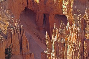
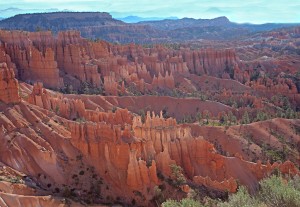
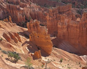
Our original plan was to find a campground in Cannonville which would put us closer to Escalante and in proximity to other locations we wanted to access. However, between the tourist traffic and a half marathon that was to take place this weekend there were no  spots to be had. So we opted for a really nice campground just outside of Bryce Canyon. In late afternoon we drove the 18 mile loop in the park stopping at most of the scenic overlooks. Never having been here before, we were both taken aback by the majesty of the jagged red rocks, the hoodoos (pillars of  fantastic shaped rock left by erosion),  and the enormity of these colossal formations.

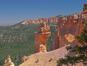
Hoodoo at Agua Canyon

Rainbow Point

We returned  around 7:30 am to try to catch the morning light as it cast a different set of shadows. We went to Sunrise/Sunset/Inspiration Points which encircle Bryce Amphitheater, the biggest natural amphitheater in the park. So far, this is my favorite place. We found out that you can enter the park any time of day so I plan to go back at sunset and hopefully catch the full moon as well.


Sunrise Point

Another view of Sunrise Point

Just a bit of info for my photographer friends–all images were bracketed because of the diversity and contrast of light hitting the rocks. The harshness of the late afternoon light was particularly difficult to deal with. I then merged each 3 images in PhotoShop CS5’s HDR processor. (My Photomatix is on the blitz for some reason.) I really tried to get close to what I saw and felt.

Because we really like this campground so much, we plan to stay for another 3 nights while exploring the Kodachrome Basin and Escalante on day trips. Then we will probably find a site closer to Capital Reef and Glen Canyon.
 

Into Utah

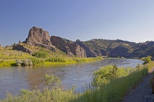
I guess I need to do some catching up. We left Great Falls, Montana on the 10th working our way along the Missouri River. We paralleled, crossed and crisscrossed this great river with the Rocky’s to our west. At one point we pulled into a recreational area to photograph this, the longest river in North America. It is 2,341 miles long and spans 10 US states. We left it as we got closer to Helena.

The Missouri River

"Big Sky" Montana


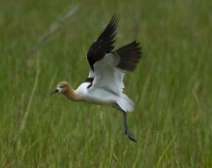
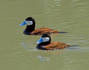
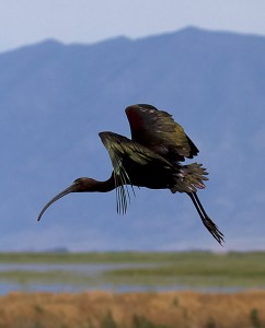
On the 11th we stayed at a campground in Idaho Falls, Idaho and headed for Utah the next day. I don’t really know what happened to Idaho but when you’re whizzing along on an interstate it’s easy to space out on the landscape.  Next thing I know we are in Utah. Because we had time to kill before getting to Salt Lake City, we decided to take a side trip to the Bear River Migratory Bird Refuge outside of Brigham City. This refuge, located on the north end of the Great Salt Lake and at the mouth of the Bear River, consists of over 74,000 acres  of marsh, open water and alkaline mudflats. It supports migratory waterfowl, shorebirds and other water birds. Before we even got to the 12 mile loop we had seen avocets, white faced ibis, yellow headed blackbirds, black neck stilts and more. The ride through the loop proved even more exciting with the sightings of white pelicans, rudy ducks, western grebes and more birds that we couldn’t identify. What an experience!

Avocet in Flight

Rudy Ducks

White Faced Ibis landing

The last two nights we were in Salt Lake City. We got the motor home serviced and Lily groomed. While waiting for both, Michael and I took a ride out to the Great Salt Lake. We had seen it so many times as we traveled across Utah in our trucking days that we needed to take one more look. We actually remembered most of the places along the way.

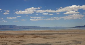
the Great Salt Lake

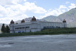
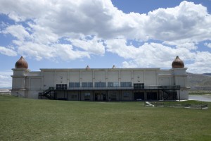
One of the most intriguing places along I-80 outside SLC is Saltair.  It was built in 1893 and was meant to be a resort/amusement park.  Known as the Coney Island of the west, it became very popular & has been struck by fire three different times (& rebuilt each time).  I (Michael) knew  of the structure from a 1962 cult movie titled Carnival of Souls.  The movie was set in SLC & the derelict building figured prominently in it as an atmospheric setting to a troubled woman’s life.  It wasn’t a particularly good movie; however, the setting stuck with me for years & the first time Barbara & I drove across I-80 in the semi, back in the ’90’s, I flipped out when we drove by it.  We couldn’t stop because we were in the truck back then, but now was our chance!

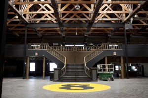
Presently, the structure is a shadow of it’s former glory.  It’s used now as a concert venue.  It can hold 4500 people inside & I don’t know how many outside.  We ran into the guy who runs the place now & he gave us a short tour & explained all the ins & outs of the place.  What a cool afternoon!

the Saltair "Ballroom"

the Saltair exterior

the Saltair "amphitheatre"

Here are a few links if you’re interested (just copy & paste the URL in your address bar):

http://en.wikipedia.org/wiki/Saltair,_Utah  – the history

http://www.imdb.com/title/tt0055830/ – the movie

http://www.thesaltair.com/ – the present venue

After 2 days in Salt Lake City, with a metro population of over a million, 2 heavily traveled interstates and a haze that seems to envelop the city and obscure parts of the Wasatch mountain range, we are happy to be on our way. Today we head for Escalante and the canyons areas of the state.


Back in the US of A

Right now we are sitting in a campground in Great Falls, Montana. But let me start from the beginning.

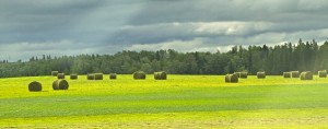
When we left Edmonton, it was a sunny but very windy day. It was great to finally see the sun after all that rain. We worked our way toward the border over good roads. The mountains were in our rear view mirror as we drove through farmland covered with beautiful canola flowers. Everywhere we looked the bright yellow flowers coated the landscape. Apparently Canada produces 17% of the world’s canola. Most is used for oil but some is now produced for biofuels. Cattle and horse farms spread over the vast plains.

Canola Fields

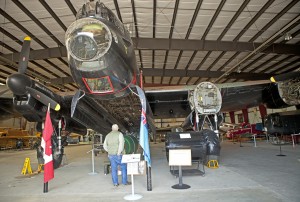
We decided to stop at a small town called Nanton (population 2,124) because they had a Bomber Command Museum Of Canada. The centerpiece of this museum that housed WWII aircraft and artifacts was the 1945 Lancaster Bomber, one of the few in the world that is still in existence. We walked through the 26,000 foot museum amazed at the planes and vehicles that were used by both the Canadians and the American flyers. It was quite an experience.

Lancaster Bomber

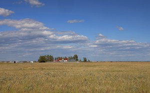
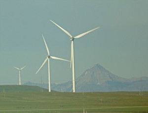
After lunching at a small park in Nanton, AB we continued south through Calgary picking up the Rockies to the west of us. For the night, we camped at one of the nicest places yet—in Ft. Macloed, Alberta. The large spaces were bordered by the plains, the Rockies and the foothills. The wind blew continuously keeping the mosquitoes at bay and cooling the intense sun. Windmills skirted the landscape taking full advantage of the strong breezes.

Farmhouse across from our campground

Windmills with the Rockys in the background

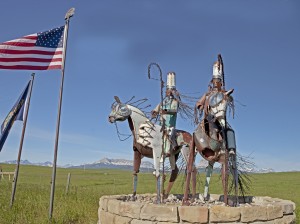
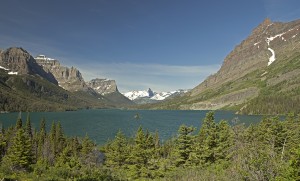
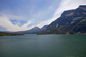
This morning we crossed into Montana happy to, at last, be back in the states. We picked a narrow 2 lane road that would take us to Glacier National Park. We knew that we could only travel 13.5 miles into the Going to the Sun Road because of excessive snow on the roads but we decided to go anyway. We saw uprooted trees strewn about by recent avalanches and snow on the ground.  We saw snow capped mountains and glaciers. And St. Mary’s Lake. We only wish we could have traveled further into the park.

Statue at the US border

View at Glacier National Park

St. Mary's Lake at Glacier

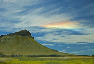
On our way to Great Falls I saw the most incredible color formation in the sky. It had the colors of the rainbow but didn’t “bow”.  I’ve never seen anything like it before but it was beautiful.

Rainbow Sky in Montana

After another 150 miles we loaded up with groceries at the Wal Mart in Great Falls, MT and now sit relaxed after a dinner of steak, mushrooms, salad and wine. Life is definitely good!


Back in Edmonton

We finally got good road. However, the gods were not entirely with us. We were inundated with torrential rain and 25 mile an hour winds all the way from Dawson Creek to Edmonton. We had actually planned to end up south of Edmonton but because the winds and rain were tossing us all over the highway, we decided it was time to get off the road.
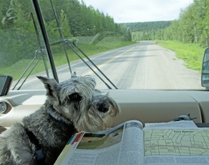
Lily checking out the Milepost

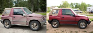
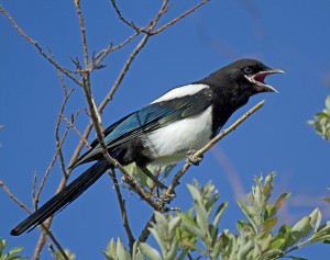
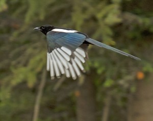
Yesterday we cleaned the vehicles. You can see the before and after picture of the Tracker.  While Michael was washing the motor home, Lily and I discovered a really nice trail where I photographed the magpie. These beautiful, noisy birds were all over the place. I also saw a red winged black bird and some sort of sparrow.

Before & After

Magpie

We checked the weather and it looks like we will have rain and wind all the way to the US border. Oh well. Guess we’ll just have to see how far we can get. We’ve heard that Glacier is not completely open to traffic yet because of the heavy snow fall this winter. We’ll check the road conditions when we get down that way and decide what we want to do.

Have a meat loaf in the oven and plan to make mac and cheese and spinach. Nothing like comfort food on a blustery day.


Dawson Creek

Spent the day cleaning the vehicles both inside and out to get rid of all the dirt and dust from the Alaska Highway.  Otherwise it was just a laid back day.

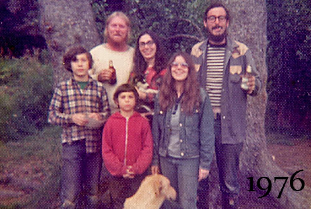
As a continuation of some of the significant events during our life in Alaska, check out the latest addition to That 70’s Blog–“The Moose Hunt”. To get the page, click on it on the Title Bar above.

Back to Mile “0”

I really don’t know where to begin—with the cinnamon bun or the wildlife. That’s how good the cinnamon bun was.  To begin with it was about 6 inches square and about 2 ½ inches thick. It was probably the most heavenly cinnamon bun we have ever eaten. It is advertised as the “best cinnamon bun in the Galactic cluster” and they are right!  It was sweet  all the way through with  the outside  swirls of  dough  soft and buttery tasting.  Along with a cup of coffee,  it was more than enough for the two of us for breakfast.  If the office of the campground had been open at 6am when we left we would surely have purchased several more. This rather unique “campground” in Teslin, YT  caters to motorcyclists and horse trailers. We were the only motor home there and they parked us on a concrete slab next to an old cluttered log barn. Log cabins were scattered throughout the grounds with a huge fuel tank the centerpiece of the place. WiFi was “not” and the electricity was turned off every night at 10. Fortunately we have a generator so this was not a problem. The small log office consisted of a gift shop, bakery and kitchen in the back. That was about it.
Teslin Campsite in Yukon Territory

We had driven most of the day through more than 200 miles of the Northern Rockies  up and down 7 and 9 % grades, through twisting roads and along rivers and creeks . We maneuvered through curves, around cliffs and ravines with no shoulders or guard rails, and swerved to miss fallen rock.  Michael spent most of his time concentrating on the road as we traversed spectacular vistas in this remote part of British Columbia.

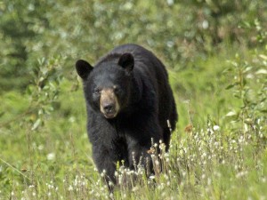
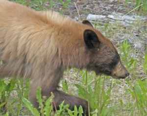
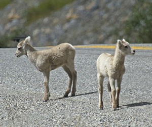
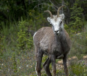
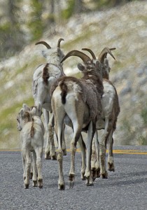
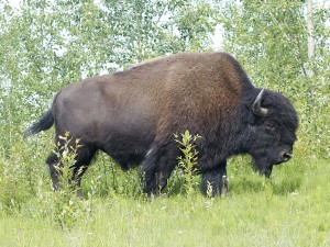
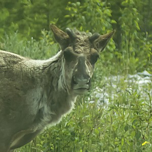
Now to the wildlife. What a day yesterday was. We probably saw as much wildlife yesterday as we’d seen on the rest of the days combined on this trip. Just as a tally, we saw 13 black bears of which 2 were brown black bears, we saw 13 bison, one caribou and several  herd of stone sheep. The black bears were grazing along the the side of the road. We almost hit two of them as they ambled across the highway. Their  coats were beautiful. The bison were also grazing along the highway  but posed no threat as they lolled along eating the grass. The stone sheep virtually stopped traffic. They decided that the middle of the road was where they wanted to be and there they stayed. There were several babies tagging along with the rest of the herd. What a delight to watch them. Today we saw 4 beautiful black bears and a coyote.

Black Bear

Brown Black Bear

Stone Sheep Lambs

Stone Sheep Ram

Stone Sheep walking off down the road

Bison

Caribou seen on the highway

After driving 345 miles today, we are now back at Mile “0” of the Alaska Highway .  As we got closer to Dawson Creek the traffic picked up reintroducing us to civilization. The highway had been ours for so long. Now we had to share it with tractor trailers and RV’s. The weather has also gotten a lot warmer. While in Alaska we got used to living with 50 and 60 degree temps. It’s 72 here in Dawson Creek and feels uncomfortably warm. I know our friends in N.C. are suffering with the 90’s and high humidity.  At least the weather has been clear and beautiful with no rain. If anyone remembers, the last time we were in Dawson Creek, it was snowing.

Tomorrow we wash all the dust and dirt from the highway off of the motor home and clean both vehicles inside. Then we are off to Edmonton  on our way to Glacier and beyond.


Whitehorse to Teslin Lake, YT

We finally left Whitehorse around 2 in the afternoon after getting our trailer hitch fabricated and welded back on to the motor home. During our wait we decided to take advantage of the areas around this Provincial capital. Outside the city limits there is nothing but wilderness.

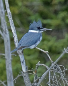
We followed the Fish Lake Road to a lovely marsh and were greeted by mosquitoes and swallows. I did see a raptor fly overhead but it was behind the trees before I got a chance to capture it. I know it wasn’t an eagle. That’s all I can say. However, I did get a good shot at a belted kingfisher.

Belted Kingfisher

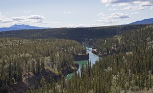
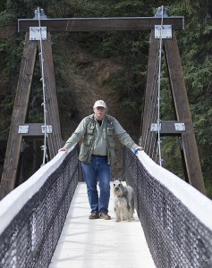
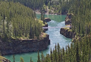
With time to spare, we headed to Miles Canyon, a narrow channel that leads to the Yukon River and was used by miners and stampeders on their way up the Yukon to the gold fields back in the late 1800’s. The red and burnished rock of the canyon, the almost green water and the suspension bridge were spectacular viewing.

Miles Canyon-View #1

Michael & Lily on the suspension bridge over Miles Canyon

Miles Canyon-View #2

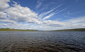
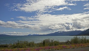
The Yukon rewarded us with gorgeous weather, blue skies and wonderfully driveable roads (at last!). Having regrouped, we headed 125 miles down the highway to Teslin. We are now camped just off of Teslin Lake which is 86 miles long and averages 2 miles across. Its name means “long, narrow water”.

Teslin Lake

Tomorrow we continue our journey down the A2laska Highway hoping to get to Dawson Creek (Mile “0”) in 2 days. The road from here on should be no problem to maneuver. I look forward to more spectacular views.


Down the Alaska Highway

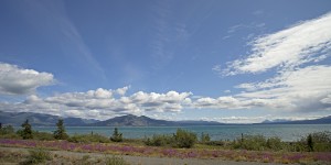
We set out from Tok, AK around 7:30 this morning. It was a beautiful, sunny day. Before we hit the border crossing at the Yukon we had already seen a moose with 2 calves  and 2 wolves. Now if we could get through the worst of the Yukon we knew we had it made. It was difficult to enjoy the majesty of the mountains and rivers as we bounced and jostled over frost heaves, dirt and gravel and through road construction. The ride was horrendous. We finally stopped at a pull off along Kluane Lake. On the way up the highway it had been too rainy and overcast to photograph this picturesque lake and its surrounding mountains. But today was perfect. (As a point of information, Kluane Lake is the largest lake in the Yukon Territory covering about 154 square miles.) I grabbed my cameras and started shooting. Meanwhile, Michael checked the motor home and Tracker for any damage from the rough ride. The hitch had broken during the incredible bouncing. We were lucky we hadn’t lost the Tracker. In addition, the Tracker had 2 cracked headlight covers.  Hopefully video & pix will follow.

We had some lunch , unhooked the Tracker which I drove and we  headed the 175 miles to Whitehorse to find a welder to fix the hitch. So here we are. We plan to be at the welding shop when it opens tomorrow morning and, hopefully, be out of here by tomorrow afternoon.

FYI-Though we have completed our visit to Alaska, the blog will continue until we get home in mid August. So follow our travels and our travails through Glacier and into Utah.

Michael put a video together on our trip to Hallo Bay Bear Camp. This is the link if you would like to see it.  http://www.youtube.com/watch?v=K1fpk5HXrmk

Especially for my brother-in-law Danny and sister-in-law Eileen– here is Kluane Lake.


Kluane Lake-View #1

Kluane Lake-View #2

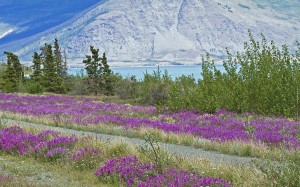
Rows of Fireweed bordering Kluane Lake

Our Last Day in Alaska

Yesterday we left Glacier View and headed  up the Tok Cutoff. Only masochists would take this bumpy, windy, occasionally gravel road a second time.  That’s us! At least this time we knew what to expect and drove it slowly—only coming out of our seats  4  or 5 times. Unfortunately, it was raining and all the beautiful mountains were shrouded in clouds. We stopped at a very large pond for lunch and searched for the trumpeter swans but to no avail. Guess I was really lucky the first time through to get the shots I did. Needless to say, I didn’t take any pictures.

I’m sitting in the motor home at the Sourdough Campground in Tok, Alaska on our last day in the 49th state.  Of course I got their reindeer sausage for breakfast. What a treat.  Unfortunately their Karaoke  “Johnny Cash” and his “June” will be performing again tonight. I was told he puts on a “show” every night but Thursday. Oh well, guess we’ll have to live with hearing his “music” resound throughout the campground.

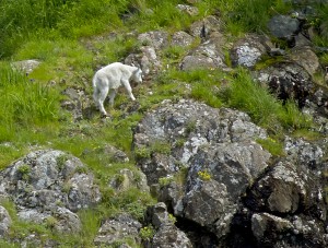
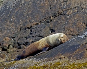
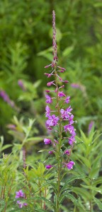
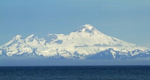
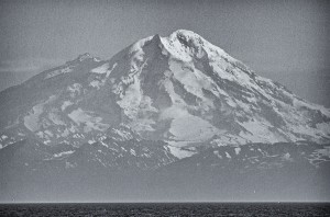
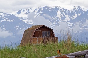
I decided to put together some recent images that I have not posted before. The mountain goat and sea lion are from my  boat ride on Resurrection Bay. The fireweed (which grows from the bottom up with the top flowers blooming as fall approaches) was taken along the Tok Cutoff.  Mt. Iliamna and Mt. Redoubt, both 10,000 foot volcanoes with Redoubt still active as of 2009 and Iliamna dormant, were taken from Anchor Point about 46 miles away. These 2 volcanoes are significant as our ashes will eventually  be scattered on them (Michael’s on Redoubt and mine on Iliamna). The Magpie was taken in Anchor Point and the old shack in Homer  with mountains as a backdrop. Enjoy! (Click on images to enlarge)

Mountain Goat

Mountain Goat

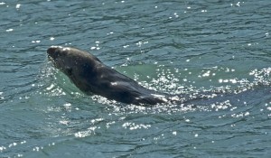
Sea Lion

Fireweed

Mt. Iliamna

Mt. Redoubt

Magpie

Old shack


Tomorrow we head back down the Alaska Highway. We’ll probably spend a couple of days at Glacier National Park and then on to Escalante in Utah.


Seward to Glacier View, Alaska

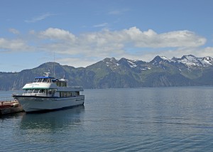
We left Anchor Point and headed to a campground about 6 miles from Seward. Again we lucked out as it was nestled in the mountains with a creek running behind us.  We spent the day checking out Seward (it’s not very big) and trying to see if we could find someone to take the 3 of us out on Resurrection Bay for the day. No luck. So I made a reservation on one of the cruise ships for their 4 ½ hour tour to Fox Island and around the Bay. Michael, who had spent some time in Seward when he went kelping back in the seventies, decided he’d stay behind, babysit Lily and look for the leak we discovered coming from the water heater (we think).

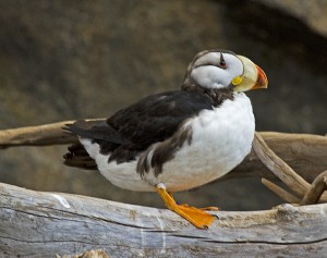
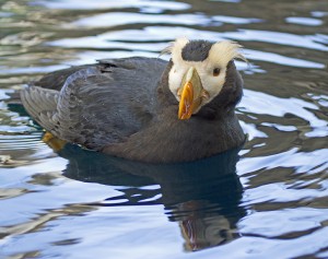
We were told that the Alaska Sea Life Center was really worth going through. So we went there prior to my boat ride. Besides providing information on sea life in Alaska, it also housed an aquarium and  rookery. I knew that I would be hard pressed to photograph puffins on the ride so I took advantage of their proximity at the Sea Life Center. (And I’m glad I did.) They had both horned and tufted Puffins, black oyster catchers, the common murre, sea lions and seals.

Horned Puffin at Alaska Sea Life Center

Tufted Puffin at Alaska Sea Life Center

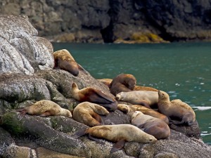
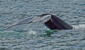
I lucked out with a beautiful day. The ride through Resurrection Bay, around islands and along glaciers was well worth the trip. I saw sea lions, puffins, mountain goats, hump backed whales and orcas. Unfortunately, trying to photograph these became a task unto itself.  I know there has to be an art to photographing wildlife on a moving boat. I was not able to master this. Every time I focused in on a puffin or a whale or a goat, the boat would heave. I spent more time trying to maintain my balance than shooting. I finally gave up—especially on the orcas. They frolicked in pairs around the boat and were just plain fun to watch. We saw a number of hump back whales that also performed for us. I did get a couple of tail shots. The puffins proved totally impossible to shoot as they skittered across the water and into the air. Nothing would stay still long enough. So I just watched and enjoyed.

Cruise Ship on Resurrection Bay

Sea Lions as seen from the boat

Hump Back Whale Tail

Sea Otter meeting the boats as they come into harbor

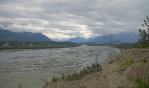
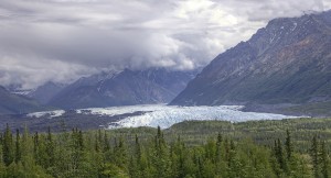
As we thought, the leak was in the water heater.   Michael set us up with an appointment with an RV repair shop in Anchorage for this morning.   Getting up at 3am, we drove the 2 ½ hours to Anchorage. After waiting another 6 hours to have the new water heater  installed,  we headed up the Glenn Highway. What spectacular views as we wended our way over curvy 2 lanes with no shoulders or guard rails through the Matanuska Valley, along the Matanuska River and by the Matanuska Glacier. Each time you think you’ve come upon the most beautiful scenery ever, you  see another mountain or glacier or river even more awesome. Alaska never disappoints.

Matanuska River

Matanhuska Glacier

Tomorrow we head to Tok, AK , the first place we stayed when we entered Alaska on June 9. We’ll be there for 2 nights and then head back down the Alaska Highway to the lower 48. We will have been in Alaska a month – not long enough but it’s time to move on.